Spatial Inequality of Accessibility To Urban Parks – case study of Auckland public housing developments
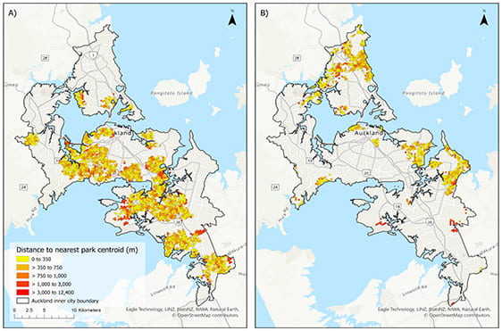
The impact of poor spatial accessibility of urban parks is specifically critical for the more disadvantaged population that suffers from greater risks of social-economical related health inequalities. In this paper, we use mobile locational dataset collected in 2020 to investigate accessibility to urban green spaces for the top (with) and bottom (without) 25% public housing neighbourhoods in the Auckland region, New Zealand.
We analysed the distance from residents’ home locations and centroids of a 300mx300m grid, to the nearest park by both Euclidean and network analysis and explored the relation between accessibility to urban green and neighbourhood deprivation (indexed by the New Zealand Index of Multiple Deprivation 2018). The results reveal that neighbourhoods with a higher deprivation index quintile ranking also have lower accessibility to urban greens in Auckland, highlighting the urgency to address the emerging inequalities in accessibility and opportunities for these neighbourhoods.
Publications:
I-Ting Chuang, Jessie Colbert, Katarzyna Sila-Nowicka (2022). Spatial Inequality of Accessibility to Urban Parks: case study of Auckland public housing developments. Presented at THE CITY IS [NOT] A TREE: THE URBAN ECOLOGIES OF DIVIDED CITIES, Pretoria, South Africa, 5-7 July 2022
